Enjoyment of the whispering winds, the zephyrs,
the airstreams of the Sierra Nevada and Great Basin areas of the
United States in a recreational vehicle.
A November 2010 Tour
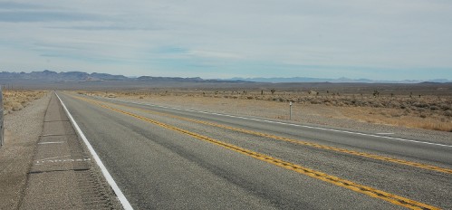
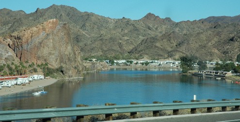
The southern desert, Colorado River corridor and
US 93
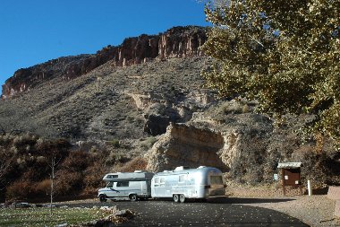
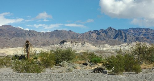
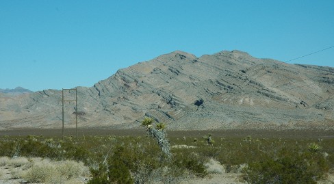
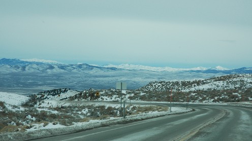
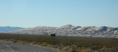
November: winter is on its way. That didn't stop us from taking a
tour of some unique parts of the Western U.S. The Sierra
Nevada Unit rally at Mesquite Campground in Death Valley provided
some of the motivation for this trip. That rally also determined the
general time frame. Taking full advantage of this road trip, we also
included a visit to a cousin near Kingman, AZ and then headed to
Quartzsite to attend a Four Corners Unit rally over Thanksgiving. As
a way to take a new route home and also check out several other
Nevada State Parks, we headed up scenic highway 93 then over highway
50 back to Reno. Despite some record cold temperatures for this time
of the year, it was a great trip. We are now eager to go back and
explore hwy 93 in better weather.
Taking the tour
Making plans
Half the fun of a tour is in the planning. This is an anticipation
where you can take a virtual tour. This used to be just plotting the
route on a map and referencing a tour book or two. Now it can be much
more in depth, even to taking a low altitude flyby of the route. You
can create a POI or points of interest catalog for your navigation
device that includes fuel stops, overnight locations, places to see,
and rest stops. You can check on lowest gas prices at planned fuel
stops, check on climatology and sun rise and set times and then check
for local weather, check for traffic conditions, and get background
on geology, history, and provenance of places you plan to visit.
- CA Road
Conditions
-
4CU
004 Q4T3 - Thanksgiving in Quartzsite - Airstream Forums
-
-
NWS Las Vegas
-
NWS Elko
-
NWS Phoenix
-
U.S. Severe
Weather Map : Weather Underground
-
Western US COOP Station
Map - climatology
-
Baker
California Gas Prices, local gas prices, Best gas station prices in
Baker California
-
Seligman
Gas Prices – Find Seligman, Arizona Gas Stations and Cheap Gas in
AZ at Automobile Magazine
-
Moapa
Gas Prices | Find the Lowest Gas Price in Moapa Nevada at Local
Clark County Gas Stations
-
Nevada
Gas Prices | Find the Lowest Nevada Gas Price at Local Gas Stations
-
Tonopah
Nevada Gas Prices, local gas prices, Best gas station prices in
Tonopah Nevada
-
Tonopah
Gas Prices - Find the Lowest Gas Prices in Tonopah, Nevada and Save
Money - Motor Trend Magazine
-
Ely
Gas Prices - Find the Lowest Gas Prices in Ely, Nevada and Save
Money - Motor Trend Magazine
Bibliography
Traveling America's Loneliest Road, A geologic and natural
history tour through Nevada along U.S. Highway 50. Joseph V. Tingley
and Kris Ann Pizarro. Nevada Bureau of Mines and Geology special
publication 26. (2000)
Nevada Mountain Ranges, George Wuerthner. American World
and Geographic Publishing. (1992)
Sierra
Nevada Airstreams home page
-|- Destinations
-|- Memories
-|- Owner's Guide
-|- WBCCI Sierra Nevada Unit home
page
-|- Community
-|- Zephyrs
weblog for the RV enthusiast
-|- Commerce
-|- Whispers
weblog of touchy subjects
-|- Our tip jar- support this website
Support
our site, Donations accepted thanks to the Amazon.com

TechComm
Labs (tm)
|
|
supporting and using open software
|
|
|

|
note: all photographs on
this site are for personal, private, and non-commercial use only. All
other copyrights are retained by the individual photographers. See
our policy. Disclaimer:
any advice or suggestion presented is provided for informational
purposes only and is correct and accurate only to the best of our
knowledge at the time it was written. Anyone using such information
does so at their own risk. Errors or omissions may exist and
additional sources of information or appropriately licensed or
qualified personnel should be consulted in deciding a course of
action. We assume no liability or obligation by providing this
information and warn any users of this information that they do so at
their own risk. All links or references to commercial vendors or
other sources of information and equipment do not intend or imply or
convey any endorsement of that source or the product. They are
provided strictly for informational purposes to illustrate the topic
at hand. Sierra Nevada
Airstreams Enjoyment of the whispering
winds, the zephyrs, the airstreams of the Sierra Nevada and Great
Basin areas of the United States is a personal,
nonprofit, noncommercial web site intended for educational and
recreational use only. This site is supported by volunteer effort and
contributions.