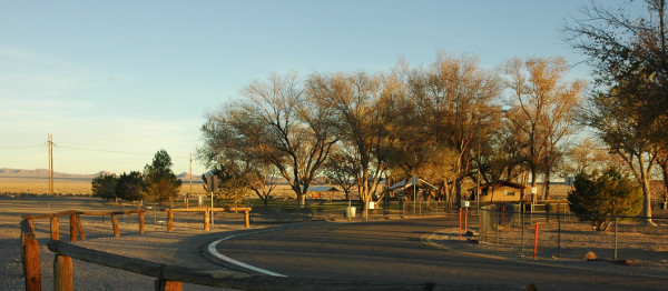
Miller's Rest stop on Hwy 95 Near Tonopah
Portions of Highway 95 are designated as the Veterans Memorial Highway. It runs from the Oregon border at McDermitt through the center of Nevada to Las Vegas and then to Cal-Nev-Ari and into California on the Southern end.

Miller's
Rest stop on Hwy 95 Near Tonopah
- AA Roads on U.S. 95 --
|
Click to see more! |
Name |
Type |
Route |
W Lon |
N Lat |
dx1 |
El |
|---|---|---|---|---|---|---|---|
|
|
NSP |
80 E; Alt 95 S |
119.210 |
39.390 |
52 |
4100ft |
|
|
|
NSP |
80 E; Alt 95 S |
119.280 |
39.290 |
56 |
4200ft |
|
|
|
Carson River Ranches – a minimally developed area of Ft Churchill State Park |
NSP |
|
|
|
|
4000 ft |
|
|
Buckland Station – another part of Ft Churchill State Park |
NSP |
|
|
|
|
|
|
|
NDW |
Hwy 95 S |
119.098 |
39.098 |
|
4331ft |
|
|
|
private |
Hwy 95 S |
|
|
|
4665ft |
|
|
|
Yerrington Roadside Park Photo Gallery - Spanish Springs |
|
|
|
|
|
|
|
|
NSP |
|
|
|
|
|
|
|
|
Private RV resort |
|
|
|
|
4720ft |
|
|
|
NFS |
Hwy 338 and 182 in California |
|
|
|
|
|
|
|
|
Hwy 359 Nevada and Hwy 167 California |
|
|
|
|
|
|
|
|
Off Hwy 359 38 miles to Hwy 338 |
|
|
|
|
|
|
|
Walker Lake – located between Schurz and Hawthorne Nevada |
NSP |
Hwy 95 |
|
|
|
|
|
|
Public |
Hwy 95 about 10 miles north of Tonopah |
117.456 |
38.142 |
|
4821ft |
|
|
|
Churchill County Fairgrounds – there is a nice campground at the Fairgrounds for use by vendors and certain event attendees. It is not generally open to the public |
County Park |
On Hwy 95 just South of downtown Fallon NV |
|
|
|
3690ft |
[ Walker Lake, Nevada Wildlife Federation ]-[ Walker Lake .org ] - [ Yahoo Travel - Walker Lake ]
|
Lahontan - 1996 -|- 2004 -|- 2006 -|- 2007 -|- 2010 -|- 2012 -|- 2013 -|- 2014 -|- 2015 -|- 2017 -|-2018 |
||
|---|---|---|
|
Ft Churchill – 2000 -|- 2001 -|- 2002 -|- 2014 -|- 2016 -|- 2018 Ft Churchill – Orchard – 2006 -|- Ft Churchill Scout Camp – 2011-|- 2016 |
||
|
Weed Heights RV Park 2009 -|- 2010 -|- 2011 -|- 2012 -|- 2013 -|- 2014 -|- 2015 -|- 2016 -|- 2017 -|- 2018 |
||
|
Sweetwater Summit - 2008 -|- 2009 -|- 2011 -|- 2014 -|- 2015 |
||
|
|
||
Also see- US 395 North - US 395 South - 50 East - Contribute - - Copyright - - Sponsors - -
Approximate distance in miles from the junction of U.S. 395 and Interstate 80 in Reno NV
Sierra Nevada Airstreams home page -|- Destinations -|- Memories -|- Owner's Guide -|- Community -|- Commerce -|- WBCCI Sierra Nevada Unit home page -|- Zephyrs weblog for the RV enthusiast -|- Whispers weblog of touchy subjects -|- Our tip jar- support this website
|
copyright 2018 Leipper
Management Group. All rights reserved Please address comments
or questions to webmaster@leipper.org
Last updated
|
Sierra Nevada Airstreams - photograph policy -supporting and using open software |
note: all photographs on this site are for personal, private, and non-commercial use only. All other copyrights are retained by the individual photographers. See our policy. Disclaimer: any advice or suggestion presented is provided for informational purposes only and is correct and accurate only to the best of our knowledge at the time it was written. Anyone using such information does so at their own risk. Errors or omissions may exist and additional sources of information or appropriately licensed or qualified personnel should be consulted in deciding a course of action. We assume no liability or obligation by providing this information and warn any users of this information that they do so at their own risk. All links or references to commercial vendors or other sources of information and equipment do not intend or imply or convey any endorsement of that source or the product. They are provided strictly for informational purposes to illustrate the topic at hand. Sierra Nevada Airstreams Enjoyment of the whispering winds, the zephyrs, the airstreams of the Sierra Nevada and Great Basin areas of the United States is a personal, nonprofit, noncommercial web site intended for educational and recreational use only. This site is supported by volunteer effort and contributions. Donations accepted thanks to the Amazon.com