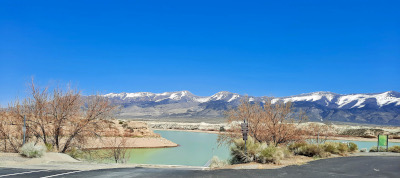
Wildhorse Reservoir
Interstate 80 follows the Truckee River down into the meadows of Reno and Sparks then through a canyon to Wadsworth where the Truckee heads north to Pyramid Lake and I80 continues to the Fernley Sink. I 80 skirts the north side of what used to be near the bottom of the ancient Lake Lahontan. Fernley Sink, Humbolt Sink, and Carson Sink are the lowest places in the Sierra Nevada Airstreams territory. I80 joins the the Humbolt river at its sink near Lovelock and follows the 'river' nearly all the way to the Utah border.
Wildhorse
Reservoir
Click to see more! |
Name |
Route |
Location |
|---|---|---|---|
|
Rye Patch Reservoir State Recreation Area - The upper part of Rye Patch Reservoir is where early immigrants found reasonable livestock grazing after an awful 44 mile trek (worse than the forty mile desert) from the Winnemucca area. It was also a decision point about whether to take the Applegate and Lassen cutoff towards northern California and Oregon or cross the forty mile desert towards the Carson or Truckee rivers. |
80 E |
Dist: 116 mi |
|
Unionville - Near Rye Patch Reservoir, East of I80. An old mining town once home to Mark Twain. Take a general tour of Unionville and Buena Vista Canyon -|- Tour the school house -|- Visit the Old Pioneer Garden Bed and Breakfast. |
80 E |
|
|
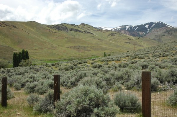
Wildhorse State Recreation Area, Big Bend and Wildhorse Crossing |
Elko 225N |
Dist: 350 mi |
|
Jarbidge – In Northeastern Nevada, North of Elko. The town of Jarbidge came into being in 1909 when gold was discovered. Now only a small population lives there full time. The town is near a wilderness area that encompasses over 113,000 acres. See the Thornburg's pictures of Jarbidge |
|
|
|
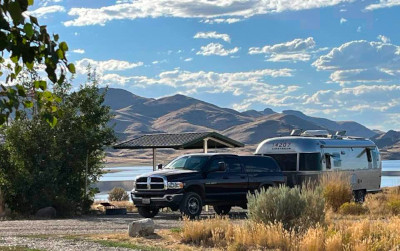
Angel Creek/Lake |
Wells 231S |
Dist: 350 mi |
|
South Fork at Spring Creek |
Elko 227S |
Dist: 250 mi |
|
Mustang Ranch: The feds got it for back taxes and are now thinking of turning the former brothel on the Truckee into a campground. Good Idea! We'll update here as we learn about progress on the idea. |
I80 E |
Dist: 25 mi |
|
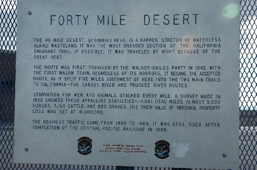
Interstate 80 through Nevada has a significant heritage as a route to the west. Most of the Oregon and California bound traffic in the nineteenth century followed the Colorado River north around Utah. The California trail then dropped south to head over the Sierra's at Beckworth (route 70) and Donner (I 80) passes. In the twentieth century, these routes became the Lincoln and Victorian Highways. The Hastings cut-off pioneered by the Donner Party went through Utah and the 90 mile salt flats to the Humbolt river in northeast Nevada. This trail followed the Humbolt until it petered out for a forty mile desert crossing to the Truckee or Carson rivers. Hastings was promoting a trail he had not experienced with a wagon train and the Donner Party, in following his advice found themselves creating a trail through the wilderness. The effort sapped their strength and delayed their progress with fatal results. |
Oregon California Trails Association, California Nevada Chapter http://canvocta.org/ see also the OCTA chapters list at http://w3.trib.com/~lwisch/chapters.htm
Route 40 - http://www.route40.net/index.shtml
Hastings cuttoff - the Roy Tea Gallery http://www.utahcrossroads.org/G_HR_Tea.htm
The Lincoln Highway Association - http://www.lincolnhighwayassoc.org/
The Victory Highway
National Park Service Historic Trails - http://www.nps.gov/cali/
California national historical trail wagon train - http://www.californiawagontrail.com/
Rye Patch Links: [ Wildernet ] - [ recreation.gov ] - [ Nv State Parks ] - [ hydrographic data ] - [ yahoo ]
Approximate distance in miles from the junction of U.S. 395 and Interstate 80 in Reno NV
Support our site, Donations accepted thanks to the Amazon.com
|
copyright 2022 Leipper
Management Group. All rights reserved Please address comments
or questions to webmaster@leipper.org
Last updated
|
supporting and using open software |
Sierra Nevada Airstreams - photograph policy - |
note: all photographs on this site are for personal, private, and non-commercial use only. All other copyrights are retained by the individual photographers. See our policy. Disclaimer: any advice or suggestion presented is provided for informational purposes only and is correct and accurate only to the best of our knowledge at the time it was written. Anyone using such information does so at their own risk. Errors or omissions may exist and additional sources of information or appropriately licensed or qualified personnel should be consulted in deciding a course of action. We assume no liability or obligation by providing this information and warn any users of this information that they do so at their own risk. All links or references to commercial vendors or other sources of information and equipment do not intend or imply or convey any endorsement of that source or the product. They are provided strictly for informational purposes to illustrate the topic at hand. Sierra Nevada Airstreams Enjoyment of the whispering winds, the zephyrs, the airstreams of the Sierra Nevada and Great Basin areas of the United States is a personal, nonprofit, noncommercial web site intended for educational and recreational use only. This site is supported by volunteer effort and contributions.